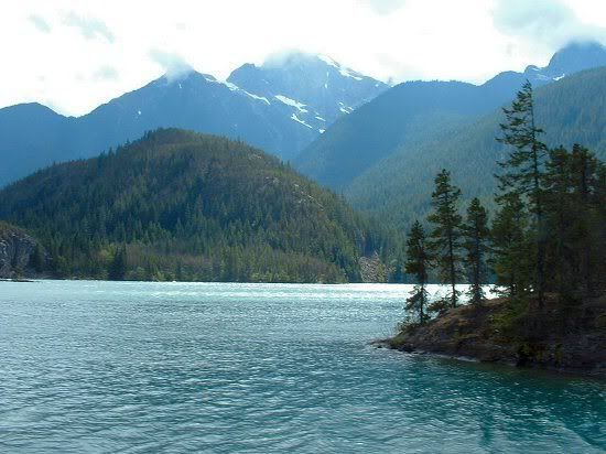
 Hope this shows up... this is where I spent Saturday, up at Diablo Lake above the Diablo Dam. Where is that? Round about here... Usually, the lake tours are booked up months in advance, but we ("we" being Mom, Dad, Granpa, and I) had a chance to go when some friends of my aunt had to cancel their plans. It's a long, long drive to the North Cascades Highway to Newhalem (where the tour starts) and back... long and tiring, but worth every mile. I'll post Photobucket picture links, so you don't have to wait forever for this page to load. As the above example indicates, it's tough to take an ugly picture in the High Cascades, especially on Diablo Lake. Nevertheless, I succeeded...
Old Number 6
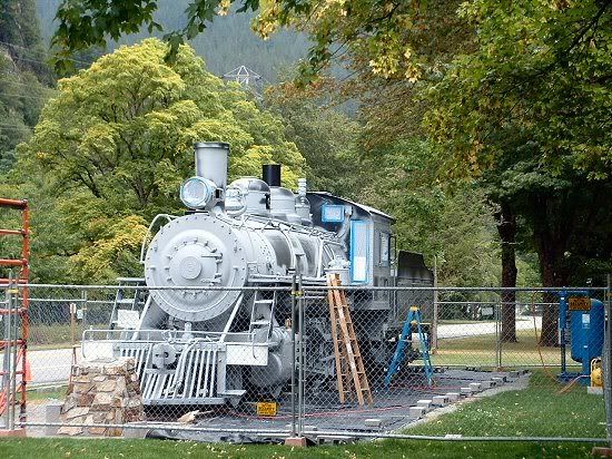
One of the first things to greet you at the visitor center is Old Number 6, the original train that, in its day, made the trip up to the dam construction sites several times a day for over a decade. It's currently under renovations, as one might surmise by the fence... and the primer.
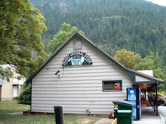
The Skagit General Store
The original Seattle Light company store still operates today, providing tourists and locals alike with junk food, tourist items, and other essentials. And fudge. They have some nice fudge in many flavors.
Towers of Power
And why did they build so far up in the hills? Why, to take advantage of alien technology left by a UFO crash, as witnessed here. This gazebo claims to use obsolete parts from the power stations, but no sci-fi buff will be fooled.
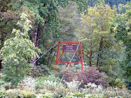
Trail of Cedars
The Trail of Cedars is a 1-mile loop across the Skagit River. It goes by, oddly enough, lots of cedars... or Western red cedars, I expect, as we don't have true cedars in this part of the country. Unfortunately, I didn't get a chance to explore because we had to wait for the tour, and by the time we got back Grandpa was ready to go home.
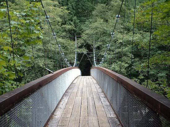
The Bridge of Cedars
Yes, just across this suspension bridge lies the elusive Trail of Cedars. This long suspension bridge... this long suspension bridge that bounces every time you take a step. (Actually, it wasn't nearly as bad as another area suspension bridge, over the Tolt river...)
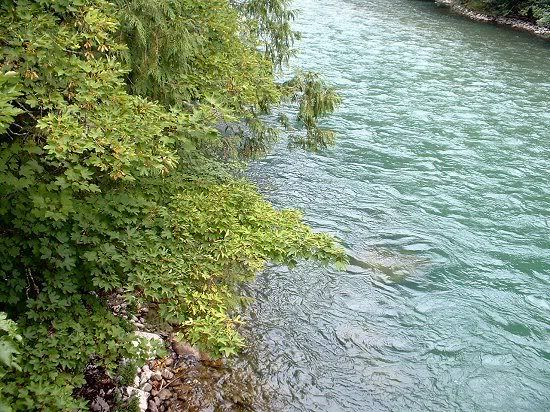
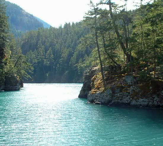
The Skagit River itself
No, I have not manipulated the water color. Due to deposits of gniess (a rock related to granite), the waters of the Skagit run nearly opaque bluish-green.
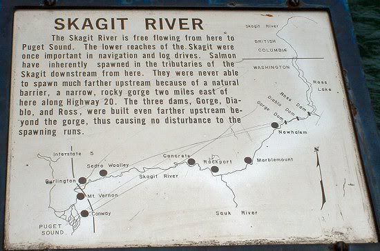
You Are Here
Yes, I know you were dying for a map of the Skagit River. And, yes, we're that close to the Canadian border at this point. I suppose technically these are partially Canadian waters... some of the water comes from glaciers north of the border. Note Newhalem, which is actually where I was at that very moment.
(Side Note: The town of Concrete actually was the source of the concrete used in dam construction up the Skagit River. Railroad cars full of slow-drying slurry were brought up by incline railway from here. So it's not just another pointlessly-named small town.)
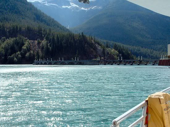
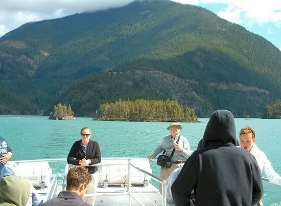
Diablo Lake and the Diablo Dam from the Alice Ross III
I really, really wish the tour bus from the visitor center had stopped now and again, but you probably don't - I missed a zillion chances to ruin the beauty of the North Cascades at scenic overlooks. But, anyway, a vaguely informative bus ride took us to our destination: Diablo Lake, above the Diablo Dam, and the Alice Ross III - which we had to drive across the dam to reach. The ship actually had to be cut in half - top and bottom - to fit through the tunnels on the North Cascades Highway. Fortunately, it had been reassembled by the time we got to it. We'll get back to the dam in a bit... for now, we're off on the lake.
(Little tip if you ever do get up to Diablo Lake - wear a hat with a firm chinstrap or none at all. There's wind up there. A lot of wind, especially down on the open part of the lake. And it eats hats. Fortunately, we all had strapped-on hats, but one tourist wasn't so lucky. The tour guides said that it had a lot of company in the lake...)
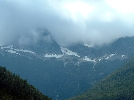
Snow in Summer
How high are we? Well, it's late August, and that's snow, so I'd say pretty high...
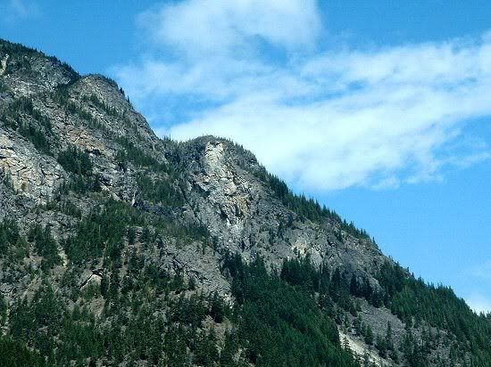
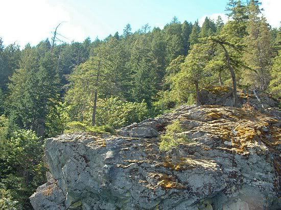
Sourdough Mountain
The peaks around here had a number of colorful names: Colonial Peak, Sourdough Mountain, Pyramid Peak, Paul Bunyan Peak... unfortunately, I couldn't pick out which was which from the boat narrative, but this one I did ID. I think. Anyways, it's a pretty mountain which I don't remotely do justice to. But, then, I didn't see a single ugly mountain in my trip.
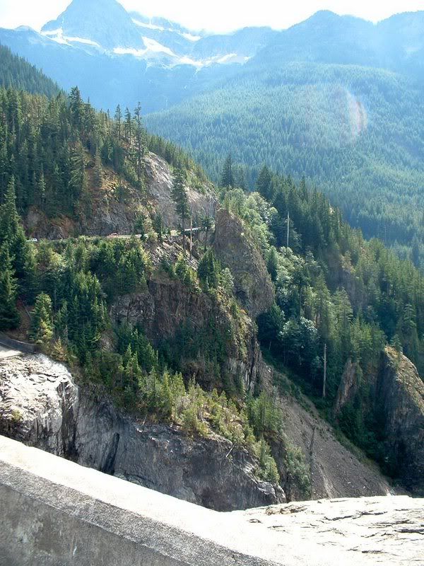
Up the Gorge
The lake narrows as you head up to the highest (last) dam in the Seattle Light network, Ross Dam. This picture is actually from the return trip, but it shows how narrow it gets.
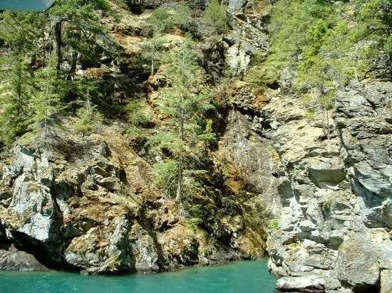
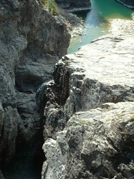
Cliffs and More Cliffs
Because there are a lot of sheer cliffs along the way...
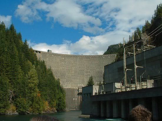
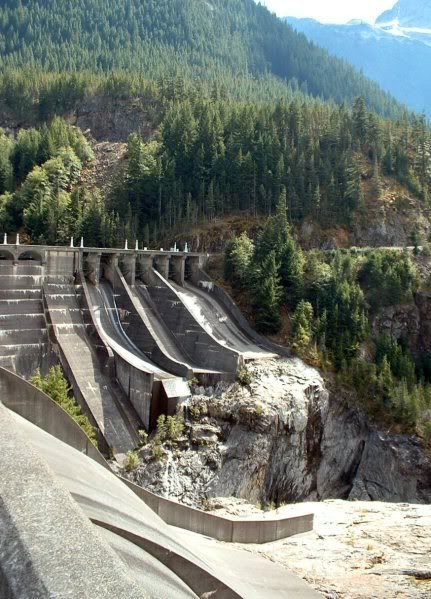
Ross Dam
End of the line for this lake, beginning of the next one... The pattern on the dam was intended to help adhere subsequent layers of concrete. At one time, plans called for another hundred-odd feet to be added, but that would've flooded more American and Canadian land, and in the 1960's they finally started figuring out that there was value in wilderness areas. As it is, Ross Lake already pokes beyond the border, and is evidently quite a sight.
Monkey and Deer Islands
From the return trip, though we saw them on the way up. Deer Island, the bigger one on the right, was named because local deer used to swim out there to give birth to their fawns, who would return to the mainland after some predator-free growing time. (I don't know if they do this anymore, though it is still a fairly remote area - there are even two boat-in-only camping places with not even a foot trail connecting them to the outside world.) Monkey Island, the little guy on the left, was so named because one of the great minds behind the project, Mr. Ross himself, would have monkeys shipped up from Seattle's Woodland Park Zoo in the summer and placed on the island for the tourists to oooh and aahh over; the zookeeper would then have to round them all up and take them to mainland sleeping facilities, to be rereleased the next day until the end of the season.
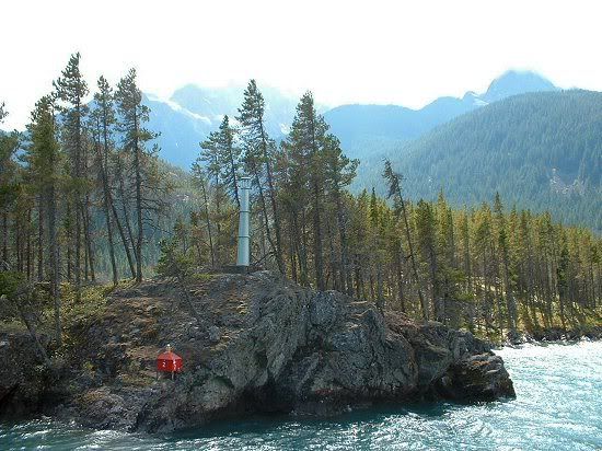
Navigation Light
A little lighthouse to help ships navigate the rocky waters of the lake in all weathers. There are actually trees down under the water still, from the valley's flooding; one enterprising dam worker tried to harvest the salable lumber, presumably with home-rigged equipment, and paid for his greed with his life. Since he was the only recorded death on the Diablo Dam project, he got a plaque on the dam to immortalize his capitalistic stupidity.
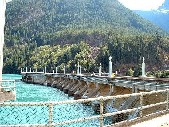
Diablo Dam Revisited
After the boat ride, we headed back across Diablo Dam... on foot. Yes, we had the option of crossing Diablo Dam on foot for the return trip. Grandpa opted out, as did Dad, but my aunt, my mother, and myself figured we'd regret it if we didn't try.
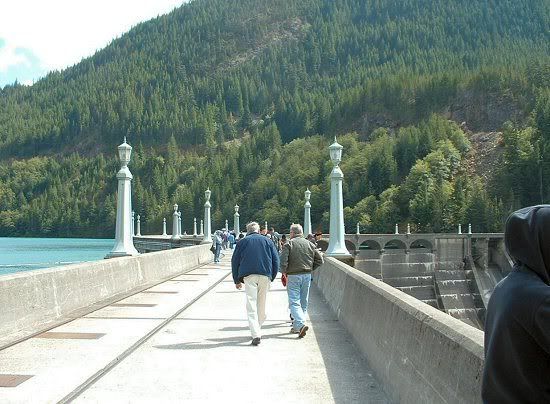
Crossing Diablo
A-walking we go. It's windy - very windy. The tour guide demonstrated the futility of spitting off the downward side of the dam by upending a full bottle of water over the edge; not a single drop of it fell more than a few inches before blasting back up and over the road and whoever was unlucky enough to be standing across the way. (Unfortunately, she waited until after we'd crossed to give us this little tidbit of info; her main emphasis on the way there was the three rules of dam-walking: Don't lean over, don't lean over, and don't lean over.)
The Drop
Boy, that's a long way down... consider that the water is roughly 350 feet deep on the lake side of the dam, and you get an idea of the dropoff on the spillway side. It's a looong way down... and you didn't have to tell me twice not to lean.
The Spillway
The spillway on the far side.
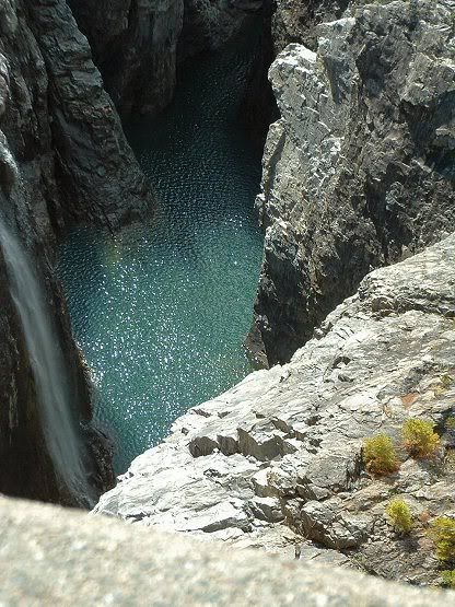
In the Gorge
Some nice rocks down there...
Waterfall below Diablo
Makes you wonder what it looks like when the spillways are going...
Another Gorge-ous Shot
Yes, I had to... Fortunately, that's the last of them.
I have many, many more pictures, and many, many, many more that I'd wished I'd taken, but I think you've suffered enough for now. Anyway, it was a long day, and a tiring drive, but I'm happy I had the chance to go.
